6,048 results
- Pictures
Map of China. Colour lithograph, 1973.
Date: [January 1973]Reference: 778012i- Maps
Map of monastic Ireland.
Ordnance Survey (Ireland)Date: 1979
- Books
- Online
Map of Roman Britain.
Great Britain. Ordnance Survey.Date: 1956- Pictures
Map of Palestine. Colour lithograph.
Reference: 576747i- Ephemera
Map / Wellcome Collection.
Wellcome Collection.Date: 2011- Ephemera
Map / Wellcome Collection.
Wellcome Collection.Date: 2009- Ephemera
Map / Wellcome Collection.
Wellcome Collection.Date: 2008- Ephemera
Map / Wellcome Collection.
Wellcome Collection.Date: 2012
- Pictures
- Online
Map of Scotland. Engraving by J. Russell, 1804.
Russell, J., active 1803-1804.Date: Febr 4th 1804Reference: 576763i- Videos
Map of life : science, society and the human genome project.
Date: 1992- Pictures
Map of British India with four vignettes. Coloured engraving by J. Rapkin, 1851.
Rapkin, J.Date: [1851]Reference: 585748i- Digital Images
Map of London and Westminster before the Fire of London.
- Pictures
Map of the Holy Land in the time of Jesus Christ. Colour lithograph.
Date: 1880Reference: 576749i
- Pictures
- Online
Map of Ireland, showing Scottish and Welsh coasts. Engraving after J. Speed, 1610.
Speed, John, 1552?-1629.Date: Anno Domini 1610Reference: 576766i
- Pictures
- Online
Map of England and Wales and surrounding seas. Engraving by J. Russell, 1803.
Russell, J., active 1803-1804.Date: 31 March 1803Reference: 576760i- Pictures
Map of the Mediterranean region described in the biblical books of Acts and Epistles. Colour lithograph.
Reference: 576723i
- Pictures
- Online
Map of Captain Cook's voyages. Engraving by W. Palmer after Lieutenant H. Roberts, 1785.
Roberts, Henry, 1757-1796.Date: 1785Reference: 566202i- Pictures
Map of India for the use of the officers of the army of India. Engraving by J. Dower, 1840.
Dower, John, active 1838-1846?Date: [1880?]Reference: 585572i
- Pictures
- Online
Map of Northern Africa; African people in a rococo frame on the upper right hand of the map. Coloured engraving, 1772.
Anville, Jean Baptiste Bourguignon d', 1697-1782.Date: 1st August 1772Reference: 576757i
- Pictures
- Online
Map of the vale of the Evenlode, Thames, charting stone formation in various colours. Coloured etching by J. Cross.
Cross, John, 1819-1861.Reference: 42448i
- Books
- Online
Map scheme of the sensory distribution of the fifth nerve (trigeminus) with its ganglia and connections [with text] / L. Hemington Pegler.
Pegler, L. Hemington.Date: 1913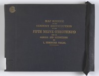
- Books
- Online
Map scheme of the sensory distribution of the 5th nerve (trigeminus) with its ganglia and connections : with text / [Louis Hemington Pegler].
Pegler, L. H. (Louis Hemington), 1852-Date: 1913- Books
- Online
Map of Worcestershire. Proposals, by George Young, land-surveyor, for publishing by subscription, a map of the county from actual survey; ... to be engraved by eminent artists. ...
Young, George, active 1772-1793.Date: [1800]- Archives and manuscripts
Map
Date: September 1982-March 1986Reference: PP/SUL/A/1/1/30Part of: John Sulston: archives- Archives and manuscripts
International HapMap Project meetings file
Date: January 2002-February 2005Reference: WT/C/3/14/1Part of: Wellcome Trust Corporate Archive